|
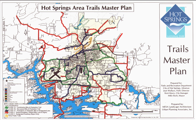
The master plan utilizes loop systems corresponding, where appropriate,
to themes based on either the history of the Hot Springs area or natural
or man-made features. Furthermore, the system is designed around identified
destinations such as business areas, schools, public facilities, and residential
areas. This offers the user a chance to utilize the trails for alternative
modes of transportation within the city's planning area as well as for
health and recreation purposes
The development of the Hot Springs Trails will be a diverse system, which
will combine various trail profiles. A large portion of the trail system
utilizes the existing city streets. Improvements to street width, intersection
improvements, the addition of sidewalks, and other such improvements will
ensure safe travel for trail users and motorists. The remainder of the
trail master plan is comprised of routes that utilize public utility corridors,
private utility corridors, utility easements, undeveloped right of ways,
abandoned railroad right of ways, active rail right of ways, creek corridors,
and private land easements. |